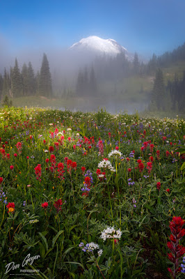
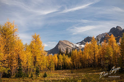
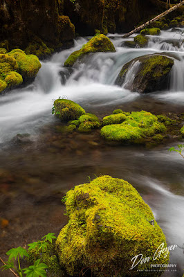
Monday, December 14, 2020

Western Landscapes 2021 Wall Calendar

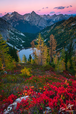
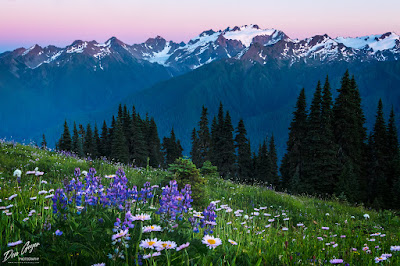
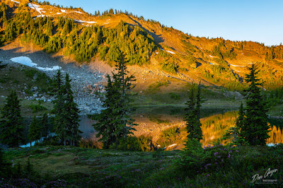
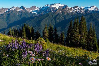
 My new 2021 wall calendar is out!  It includes images from all over the western U.S. and Canada, including Mount Rainier NP, Olympic NP, North Cascades NP, Death Valley NP, Canyonlands NP, Assiniboine PP, Yoho NP and more!

You can purchase this calendar here!  Right now you can save 15% by using the code WINTER15!  This is only for a limited time!

I've been creating these calendars to share my travels for several years now, and the project just keeps getting more exciting for me each year. 

In fact, it's hard to choose which images to include as I have so many favorites and keep building on them.

You can view these images and more by visiting my website at www.mountainscenes.com.  Prints are available.

As always, thanks for looking and enjoy the holidays!  Stay safe!


Saturday, November 28, 2020

Golden Lakes Loop in Chelan Sawtooths


Image of Upper Eagle Lake Reflection, Chelan Sawtooth
Reflection in Upper Eagle Lake
This last October I ventured into a new area of our mountains in Washington for the very first time - the Chelan Sawtooth.  What an amazing place in fall!

I must preface my story with the fact that I came directly from the Rainy Pass area along the North Cascades Highway, where trailhead parking lots were beyond full.  Parked cars could be seen on both sides of the highway, stretching as far as a quarter mile away - on a weekday.  It was crazy.

Image of Upper Eagle Lake reflection, Chelan Sawtooth
Reflection in Upper Eagle Lake
The Chelan Sawtooths offered a much different atmosphere.  This became evident as soon as I turned off Highway 97 onto a series of forest service roads that seemed to go forever.  I arrived at the Eagle Lake TH to a nearly full parking lot and disappointment set in.  Crowds were what I was hoping to avoid.

I would soon learn that most trail traffic consisted of day hikers and mountain bikes.  The only backpackers I encountered my first day was a family on their way out, that told me I would likely have the place nearly to myself.  They would not be wrong.

The approach to Upper Eagle Lake was a hot, dry one.  I would have preferred an earlier start, but dems da berries!

Image of Upper Eagle Lake reflection, Chelan Sawtooth
Reflection in Upper Eagle Lake
Views really opened up the last mile or so of trail and helped take my mind off the work up.  Soon I was at the junction and turned right to gain the upper lake at 7,110'.

I arrived to find some dayhikers lining the shores of the lake in the campground, enjoying the afternoon sun and the escape from suburbia.  I think I chatted with most of them - all super nice.  One by one the left and I was left alone.

I did some evening photography of the area, but it was very clear that morning would be the best light.  Still, it confirmed that the lake's backdrop was east facing and allowed me to start planning my morning.

The next morning was spectacular as expected and my photography actually started with moonlight, not sunlight!  Can you pick which image(s) above?

Image of Panorama of Cooney Lake and Fall Larches
Phone pic of Cooney Lake from a ridge high above
Soon it was time to pack up and move out.  I had a long day ahead - longer than even I realized!  I descended back to the main trail, then climbed up and over 7,590' Horsehead Pass and dropped down to Boiling Lake.  The views from the trail this entire stretch were amazing.

There was a couple camped at the lake.  We exchanged nods as I took my first break of the day.  Just a quick bight before moving on.

After descending down to a creek crossing and ascending the other side, the country soon became wide open.  Grass meadows extended far and wide with very few trees.  Views to the prominent peaks of the North Cascades were amazing!

Image of Martin Lake reflection, Chelan Sawtooth
Reflection in Martin Lake
Soon the trail began a to switchback steeply to gain the 8,000' saddle below the summit of Switchback Peak.  The views from the saddle were incredible, with better views back towards the North Cascades and into Canada, but also east down to Merchant Basin and out to Central Washington.  This made an excellent snack stop, and is where I encountered my first mountain biker.  We exchanged quick pleasantries and then he was on his way.  He was doing my trip in reverse, and got a late start!

The descent into Merchant Basin was quite steep, and soon I began encountering more mountain bikers.  All were super nice and always gave me the right away - stepping off the trail and hoisting their bikes above them.  I honestly felt guilty watching parties of 5 or so doing this, when I was travelling solo.  I began reversing the rule of etiquette so as not to inconvenience.

After a traverse above Merchant  Basin (the trail only descended part way into it before reaching a junction), Cooney Lake came into view in all its splendor.  The area was golden!

My descent continued down towards the lake and traversed past it on the south side.  Part of me wanted to go explore it, but I was tired and needed to get to Martin Lake, my destination for the evening.

Image of Martin Lake reflection, Chelan Sawtooth
Reflection in Martin Lake
I finally reached the Martin Lakes junction and found a place to sit and nibble on some food.  Soon a lady came up the trail from below, followed by her husband.  They had the same destination in mind.

They were from Spokane and we share many stories, including of the Idaho Sawtooths, where I had recently spent time and they were regulars.

Soon I excused myself, donned my pack, and headed up to find home for the evening.

I arrived at the lake to find it vacant, and dropped my pack at a lakeside site.  Soon the other couple arrived as well, and we elected to be neighbors.  We picked up the conversation where we left off.

Image of Martin Lake reflection, Chelan Sawtooth
Reflection in Martin Lake
That evening I traversed around the south side of the lake and found a composition I really liked with some dead snags along the shore (above).  I was fortunate to find the scene with reflective waters, as they disappeared quickly.

The winds picked up and lasted through the night.  My expectations for morning reflections disappeared.  But to my surprise, they greeted me as I poked my head out of my tent!

I enjoyed a spectacular morning with a show of pink clouds to the east that was second to none!  I watched them in fascination and envy for much of the morning, wishing I was in a location to photograph them.  But the fact is, they were the reason for the fantastic light that I did receive.

Image of Martin Lake reflection, Chelan Sawtooth
Reflection in Martin Lake
Soon the show was done and it was time to pack up and begin my descent back to the TH.  

My exit was uneventful, thought I did pass the most people of my entire trip - all heading up for the weekend.  I smiled as I realized I had timed my visit perfectly.  I also smiled to know that on one of the most popular times for fall colors near Rainy Pass in the North Cascades, I escaped the area to find solace and peace in a new area, with colors at absolute peak.  It was a fantastic trip.

Final stats for the trip were 26.1 miles, 5,640' gain.

I will say that this trip opened my eyes to many potential future trips in the area.  This is an area I would definitely like to explore more.

I hope my story helps you in planning a future trip to this area.

See you on the trail!

Saturday, October 24, 2020

Fall in the North Cascades!

Fall colors above Rainy Lake
The North Cascades are a fabulous place to spend time in the fall with vibrant colors all around.  The fall season begins as early as mid September in some areas, and lasts to mid-October in others.

A visit to areas around Mt. Baker in mid-September will find the berry leaves on fire.  Some of my favorite hikes for these are Boulder Ridge, Rainbow Ridge, Park Butte and Ptarmigan Ridge.  I'm sure there are more!

As the month of September moves on, many more places begin to turn vibrant red throughout the range.  By the end of the month, hikes near Rainy and Washington Pass along the North Cascades Highway (SR-20) become VERY popular destinations (too popular - go on a weekday and go early or late in the day).

The arrival of October sends most fall color enthusiasts into pandemonium!  Not only are the reds still typically vibrant, the needles of larch begin to turn gold.  Peak for the larch are typically close to mid-October.  By the time they are truly at peak, much of the reds will have likely disappeared in my experience.

Larch are found on eastern side of the Cascades only, mostly (if not entirely) north of I-90.  In the North Cascades, excellent places to view them are near Washington and Rainy Pass, as well as hikes reached from Winthrop, Twisp and Carlton.

Fall colors below peaks of the
North Cascades
Early October is also a fantastic time to make the drive to Artist Point, located at the end of the Mount Baker Highway (Highway 542).  There are no larch here, but picture perfect scenes exist right from the parking lot for those not wishing to hit the trail.

Of course every year can be slightly different on the timing, mostly based on temperatures and weather patterns.  The amount of precipitation during the summer months can also play a huge factor on the quality of colors.

In my experience, the biggest challenge to viewing late season colors are the big white snowflakes!  It can snow at any time in the upper elevations of the Cascades.  But the North Cascades seem to be especially prone to it, and likely in early to mid-October.  I have tried to revisit one of my favorite larch viewing backpacks on multiple occasions.  While my first visit at peak time went off perfectly, all my subsequent attempts have ended in being turned back by deep snow or storms.  So I've learned not to take anything for granted!

There are some things to be careful for during this time.  First off, it is hunting season.  So if you are visiting an area outside of North Cascades National Park, be sure to where bright clothes to be easily seen.

Mount Shuksan Reflection
The second is to be prepared for cold temperatures.  Sunny and nice days can be even colder than snowy days due to the lack of cloud cover insulating the air.  This is especially a concern in early mornings and late evenings.  Even if it is comfortable outside when you start out, be sure and throw some warmer layers in your pack, including jacket, hat and gloves.

As always, thanks for looking!  You can view more of my images from the North Cascades in my North Cascades Gallery.

Hope to see you on the trail!


Sunday, October 11, 2020

Bears!

Image of mother black bear
A mother black bear with her two cubs behind her.
 I love photographing bears!  Well, let me back up.  I love seeing bears on a hike or backpack.  For me, it adds to the experience of the trip and generally guarantees me coming home with a smile on my face, no matter how the rest of the trip may have been.

Being able to photograph bears takes the experience to an all new level.  It also requires much more planning, preparation and heavier camera equipment than I would typically take on a hike.  This is because larger lenses are required.  I would say a minimum 300mm lens to be successful, but larger would be better.

Image of black bear cub eating berries
A bear cub reaches high up for berries on a bush.
My "go to" lens is my 200mm 2.8 lens coupled with a 2x teleconverter, equaling 400mm total focal length.  This allows me to photograph from a safe distance away so as not to disturb the animals in their natural environment.  

The three images appearing here were taken over about a 40 minute span, requiring much patience to catch the glance of the bear.  I missed a couple of opportunities, admittedly.  Three quality images in 40 minutes of work?  Yep.  Because the bears were at ease and pretty much ignoring me.  Coming back with 30 quality images would mean I likely had the bear's undivided attention, which would mean I was disturbing them and causing undue stress, not to mention risking my own well-being.

These images were recently taken from a trail at Mount Rainier National Park.  Much of the time was actually shared with a volunteer park staff member as we watch the cubs feed!  We were both pretty giddy and had permanent smiles on our faces!

Image of black bear cub
A bear cub glances around its surroundings while nibbling
on berries.
This brings up another helpful hint when wishing to photograph bears.  Truly wild black bears in the Pacific Northwest are typically afraid of their own shadow.  They spook easily and run at the slightest sound or movement.  I have found the best places to photograph bears are in national parks where they are somewhat accustomed to the presence of humans.  I have enjoyed my best opportunities in Yellowstone, Olympic and Mount Rainier, and close to populated areas of the parks (not in the backcountry).

My new website is still a work in progress and I have not uploaded my Wildlife Gallery yet.  Hopefully this will happen soon!  However, you can view my landscape photography from all over the Western U.S. and Canada at www.mountainscenes.com.

As always, thanks for looking!  Stay safe!


Saturday, September 12, 2020

The Sawtooth Wilderness of Idaho


Image of Alice Lake reflection, Sawtooths
Alice Lake Reflection.
Edit:  You can now view these images in my Sawtooth Wilderness Gallery!

This trip was my introduction to the Sawtooth Wilderness of Idaho, so I wasn't really sure what to expect, other than great scenery.  I was not disappointed to find there was so much more!

It was a nearly 10 hour drive from Seattle, with much of it on two-lane country and forest service roads to the small town of Stanley.  It was a pretty crazy place at 3:00 in the afternoon, with gas station lines up to seven cars deep!  I would highly recommend gassing up and securing your provisions along the way (elsewhere).

I arranged to meet Brian of Sawtooth Transportation at the Redfish Lake TH.  There I would leave my vehicle and be shuttled by Brian to the Pettite Lake TH to begin my one-way backpack.  Brian was awesome and I highly recommend his company if a shuttle is in your plans!

image of Alice Lake reflection, Sawtooths
Alice Lake Reflection.
We arrived at the Pettite Lake TH around 4:00 pm, and I began to weigh my options for the evening.  My hope was to camp at the TH for an early morning start, but this was not an option.  So I got my gear together and began hiking up the Alice Lake trail in search of a place to call home for the evening.  I found one just past the trail register, about a mile in at the far end of the lake.

I didn't get much sleep that night however.  While the lake sports a campground and day use area on this side, the other side consists of summer vacation homes, and the parties went late.

The next morning I got a 7:00 am start up the trail, hoping to arrive at Alice Lake late enough to allow sites to empty, but early enough to snag a nice site.  It worked.  I arrived as the last party left the coveted peninsula, and snagged a site at the far tip with fantastic views of the peaks across the water.  This area began to fill up as the afternoon went on.

Image of Twin Lakes, Sawtooths
Phone pic of Twin Lakes from Snowyside Pass.
I would probably do things differently next time.  There are some beautiful sites at the foot of the lake.  The lake water had a foul taste to it, despite my filtering it.  I soon discovered that one did not have far look to find toilet paper about.  How I am not certain as there is no privacy at these sites.  One has to walk quite away to conduct one's business.

If I have one complaint about the Sawtooths, it's the lack of waste management.  Their are no pit toilets, even in the most popular areas.  This is compounded with the fact that established campsites are commonly within 10 feet (or less) of the water.

After setting camp and resting, I went up and scouted Twin Lakes.  Very nice.  Not nearly as crowded.

I awoke a couple of times during the night to photograph the Milky Way, then awoke early for sunrise.  The previous day had been quite windy all day long at the lake.  But morning brought beautifully still waters that offered the anticipated reflection of the surrounding peaks.

My plan was to head to Imogine Lake this day, but I soon realized it was not going to happen.  I stayed too late in the morning at Alice Lake for photography, and I hadn't adjusted to the elevation yet.  Coming from sea level, ~9,000' was quite an adjustment.  I huffed all the way up to Snowyside Pass and realized Toxaway Lake would have to do.

Image of Toxaway Lake, Sawtooths
Phone pic of Toxaway Lake from the trail to
Sand Mountain Pass.
Toxaway Lake was very crowded.  It proved to be a popular destination for fishermen, boy scouts, church groups - you name it.  Finding a campsite at noon was a challenge.

I set camp and again spent the afternoon resting.  While re-evaluating my itinerary, I came to the conclusion that my next day's destination - Imogine Lake, was not going to work out.  I would have to follow it by hiking all the way from Imogine to Cramer Lakes (13+ miles and climbing over two 9,000' plus passes) the next day to keep my schedule, which I was not confident I could do.  Falling short likely would mean sacrificing Baron Lakes, which I was not willing to miss out on.

So I awoke early the next morning and began the climb up to Sand Mountain Pass.  I felt much better and even had a hop in my step, which put a smile on my face.  It was going to be a good day!
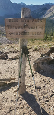
Image of Sand Mountain Pass, Sawtooths
Phone pic at Sand
Mountain Pass.
Sand Mountain Pass was awesome!  I enjoyed a nice break before beginning my descent down to Edna Lake.

Edna Lake was beautiful and mostly vacant.  Lots of nice campsites.  I traversed its shores and continued descending the south fork of the Payette River.

Somehow, I missed the trail junction with the Hidden Lake trail.  I was about 1.5 miles past it when I realized this and had to backtrack.  As frustrating as it was, I had to laugh.  I realized this was going to put my day's mileage above 13 miles - the number I was trying to avoid!  But I felt good about myself and confident.

I arrived at Hidden Lake in not much time and stopped for a break.  I've often heard of the Sawtooth range being compared to the Sierras of California.  But honestly, many areas actually remind me more of the Wind River range of Wyoming.  This was one of them.

The climb from Hidden Lake up to Cramer Divide was a grunt, mostly toward the top.  At 9,500', this would be the high point of my entire trip.  It was beautiful.

The descent down the backside to Cramer Lakes was steep.  I can't say I would want to have to ascend this route, especially on a hot day.

image of Upper Cramer Lake reflection, Sawtooths
Upper Cramer Lake Reflection.
I didn't know much about Cramer Lakes.  They were supposed to be a layover stop for me on my way to Alpine and Baron Lakes.  Little did I know just how beautiful they were!

Despite this day being my longest of the trip, I had no problem finding a nice campsite on the isthmus between the upper and middle lakes.  The views were quite nice, and evening brought some very special light and calm waters on the lake.

I met a group of guys from Portland here, who were basically doing my trip in reverse.  We chatted off and on throughout the afternoon.

Image of Upper Cramer Lake reflection, Sawtooths
Upper Cramer Lake Reflection.
The next morning I got an early start on my descent to Flatrock Junction.  The ford of Redfish Creek was very straight forward, and I set my sights on the steep climb to Alpine Lake.

I wasn't sure what to expect at Alpine Lake, other than the crowds.  Everything I read and heard was that it was a very popular place, and one should seek solitude elsewhere.  Apparently the crowds did not get the memo as I arrived to find it deserted!  I set up camp and had the entire campground to myself until 6:00 that evening, when another group finally showed up.  We were the only two parties for the night.

The day was quite windy and it was evident that there was a change in the weather.  That night I heard the pitter patter of rain drops on my tent for the first time.  It didn't last long, however.

Image of Alpine Lake, Sawtooths
Morning light above Alpine Lake
I awoke to some clouds in the sky and wind on the lake.  There would be no morning reflection, but there was still some nice light.

I soon packed up and hit the trail for Baron Lakes on the other side of the divide.

The views from the divide were excellent and soon I was descending down to Baron Lakes.  Upper Baron Lake was quite nice and sported some awesome campsites just off the trail.  But I continued down to Baron Lake itself, and was thankful I did.  I arrived to find I again had the campground all to myself and would for most of the day, only eventually sharing it with one other party.
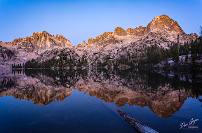
Image of Baron Lake reflection, Sawtooths
Baron Lake reflection before sunrise.
There had been some excitement in this area prior to my arrival.  The day before I began my trip, a 4.3 earthquake hit the area.  The earthquake triggered the summit of Baron Peak to fall off the mountain!  You can see in the picture to the left (and below) white streaks on the peak to the right.  This is where all the rock slid down the mountain.  Two different parties captured much of the event on video.  You can easily find it on YouTube.

I found Baron Lake to be spectacular and my favorite lake of the entire trip.  I spent the afternoon wandering around and scouting for photography.  Again I got up several times during the night for star photography.  This was the coldest night of my trip, with the temperature dipping down to 37 degrees F - in August.  The temperature range in the Sawtooths were quite extreme during my trip.  Daytime temps were commonly in the 80's, but nights would be in the low 40's.

Image of Baron Lake reflection, Sawtooths
Baron Lake Reflection.
Morning found a beautiful reflection on the lake that I couldn't get enough of!  I scampered around for different compositions as the light increased on the peaks above, eventually realizing the best was behind me and it was time to move on.

This was my exit day.  I would backtrack over the divide back to Alpine Lake, Flatrock Junction, and descend down to Redfish Lake to catch the water taxi across the lake and back to my vehicle.  Only the section past Flatrock Junction would be new to me.

As I descended, I was amazed at the amount of uphill traffic going to Alpine and Baron Lakes.  I began to realize that the solitude I got to experience may have been the exception to the rule, and considered myself lucky.

Image of Baron Lake reflection, Sawtooths
Baron Lake Reflection.

I arrived at the dock just in time to see the water taxi making its way across the lake toward me.  My trip was done - 47.2 miles and 6 days later, and many memories.

You can now view these images in my Sawtooth Wilderness Gallery!

As always, thanks for looking and I hope to see you on the trail!


Monday, August 24, 2020

High Divide, Olympic National Park

Mount Olympus above flower meadows on High Divide, Olympic National Park, Washington, USA.
Mount Olympus above flower meadows on High Divide.
I've been wanting to return to High Divide for a few years now.  Of course, permits for Heart Lake and Sol Duc Park were long taken.  But I was able to benefit from a timely release of walk-up permits made available online for Seven Lakes Basin, and acted quickly!

For where I wanted to photograph on High Divide, Seven Lakes Basin was not optimum.  But it beat descending with headlamp back to the car after evening photography!

I got an early 7:00 am start on the trail, after driving over from the Seattle area.  The ascent went pretty quickly, and is incredibly scenic once above Deer Lake as one climbs and traverses through parkland meadows.  Flowers were incredible, especially once gaining the ridge and traversing to the Seven Lakes Basin junction.

Early morning light on Lunch Lake in Seven Lakes Basin, Olympic National Park, Washington, USA.
Lunch Lake in Seven Lakes Basin.
The only difficulty on the trail is just before the junction where the trail has been wiped out due to a landslide, and one must follow cairns through a boulder field.  After a short climb to the notch, you are welcomed with a steep descent down to the lakes.

I spent most of the afternoon relaxing and enjoying the sun.  Around dinner time, I gathered my camera gear and headed up to the divide via the shortcut trail.

It was about 2 miles to my favorite flower meadow, pretty much overlooking Heart Lake.  It would be a headlamp jaunt back to camp and I was prepared.

The evening was enjoyable as I watch the sun set, casting pink alpenglow on the mountain.  Of course, this is followed with the Belt of Venus and the earth's shadow taking over the sky before the stars begin to appear.

Mount Olympus above flower meadows on High Divide, Olympic National Park, Washington, USA.
Mount Olympus above flower meadows on High Divide.
The trek back to camp in the dark half an hour after sunset wasn't as bad as I imagined.  In fact, my headlamp never left my pack as I was aided by the light of a quarter moon.

Then it was a late dinner and bed, with an everlasting grin on my face from another fantastic evening experience.

You can view more of my images from Olympic NP in my Olympic Gallery.

As always, thanks for looking!  Hope to see you on the trails!

Wednesday, August 19, 2020

Flowers At Mount Rainier!

Flower meadows along the Naches Peak loop trail at Mount Rainier National Park, Cascade Range, Washington, USA.
Flower meadows along the Naches Peak loop at
Mount Rainier National Park.
 If you sense some excitement in my prose, you would be correct!  Flower season in the mountains is so short, because the growing season is so short.  These meadows spend the majority of the year buried under a deep snowpack, and only get to come out to play for a couple months out of the entire year! Different varieties of flowers can have different schedules.  Some years these schedules match for the most part, some years they do not. So when everything starts coming together it is reason to get excited!

At Mount Rainier, the flower show arrived a couple weeks ago in typical fashion - by beginning their tour on the east side of the park around Tipsoo Lake and Sunrise.  While these areas are no longer in peak, others are!  Try a hike up to Spray Park or Indian Henry's Hunting Ground or simply enjoy a short walk/hike around Paradise or Mazama Ridge.  Now is the perfect time!

Please remember to be respectful of the meadows.  The growing season is so short that even the lightest of tread can cause irreparable damage.  As my kid's patches used to say (handed out by the National Park Service), "Don't Be A Flower Stomper!"

This year is even crazier than most.  I spent a weekend morning at Sunrise photographing a couple weeks ago.  When I arrived back at the parking lot shortly after 7 am, it was already full.  By 8:30 am, the entrance was already closed and there were cars lined up for a quarter of a mile!  (By comparison, I came up the very next day - a weekday, and it was quite the opposite).  With this increase in traffic comes an increase of pressure on such fragile environments, which we all should be cognizant of.

Flower meadows along the Naches Peak loop trail in Mount Rainier National Park, Cascade Range, Washington, USA.
Flower meadows at Mount Rainier.
This is not unique to our area.  It's happening all over.  I just returned from the Sawtooth Wilderness in Idaho and experienced much the same.  A shuttle service I used told me he had never seen such crowds in all the years he has been in the area.  His thoughts were that it was the culmination of cabin fever and not being able to travel.  I can't say that I can argue with his assessment.

Anyway, back to the flowers!  Lupine, paintbrush, asters, common cow parsnip, false hellebore, and so much more!  Or, maybe you know them as the red ones, purple ones, yellow ones - that's alright too!  The importance is the enjoyment!

If you would like to see more images from this area, feel free to visit my Mount Rainier Gallery.

As always, thanks for looking!


Monday, August 17, 2020

The Crazy Year We Call 2020!

This has been a year unlike any I can remember in recent times.  I've been planning to update my blog for about four months now, but have just been so busy.  My plans and intentions have been there.  I enjoyed some excellent photography trips in May and June, mostly shooting waterfalls on the east side of Mount Rainier.  They were excellent trips that I was very excited to share.  But alas, before I knew it time fast-forwarded to a new month and such a trip was no longer relevant to the times.  This is how this year has seemed to go for me!

So, I thought I would take a moment to simply update you on what has/is happening in my life and move on from there.

Of course, the elephant in the room is COVID-19.  I think this pandemic has changed the lives of just about everyone of us in a major way.  So many things that we have taken for granted in our everyday lives are no longer such.  We are living in different times now for sure.

On the home front, I have two teenage kids who I am extremely proud of.  My daughter is a senior in high school and is spending most of her time applying to colleges.  Our plan was to set time aside to go visit various campuses, but those times have passed.  Now its virtual online tours.  Sigh.

My son is a freshman in high school and just coming off ACL surgery. While doing so, he somehow found a way to break his Tibia while jumping into the air to try and dunk a basketball.  I had never heard of such a thing.  He has it all on video.  His friend was documenting the moment.  The result was immediate surgery to screw it back together.  He is now enjoying the fun of rehab all over again.  I suppose he couldn't have picked a better time with most select sports being cancelled.

Beside all these fatherly responsibilities, I have indeed been finding time to get out!  I've enjoyed photography trips to Mount Rainier NP, Olympic NP and even the Sawtooth Wilderness in Idaho - my first venture into this fantastic mountain range!  I also have many more adventures planned in the coming weeks.

I'm excited to be able to share all these magnificent trips with you in the coming days and weeks ahead.

I hope you are finding time to get out and staying safe as well.


Saturday, May 30, 2020

Kootenay National Park In Autumn

Golden larch above Floe Lake and the Rockwall in Kootenay National Park, British Columbia, Canada
Golden larch in Kootenay National Park, British Columbia
Kootenay National Park resides on the British Columbia side of the Great Divide.  It neighbors Yoho National Park, Banff National Park, and Assiniboine Provincial Park.  It helps make up the four national parks and two provincial parks that are commonly simply referred to as "The Canadian Rockies".

The crown jewel of Kootenay National Park has to be Floe Lake beneath the backdrop of the magnificent Rockwall, especially as viewed from Numa Pass.  It's a popular destination for backpackers and permits can be difficult to come by.  But if one plans ahead, they are readily available and the rewards await.

Towards the end of September, the larch change into their glorious robe of gold, announcing the end of summer and the beginning of cooler days and chilly nights in the prelude to winter.  It's a magical time to be in the mountains.

This image is not the classic image of the area, but does capture the beautiful color of the larches above Floe Lake.  It currently is appearing in an editorial magazine in Taiwan.

If you wish to see more images from this area, you can view them in my Canadian Rockies Gallery.  I hope to have these images and more loaded to my new website soon.

Thanks for looking!

Monday, May 25, 2020

A Treasure in the Buckhorn Wilderness

A waterfall along the Quilcene Riverl in the Buckhorn Wilderness, Olympic National Forest, Washington, USA.
Waterfall along the Quilcene River.
I recently revisited one of my favorite drainages of the entire Olympic peninsula in Washington State - the Quilcene River.  This drainage resides on the east side of the peninsula and sports a beautiful rain forest along a the very scenic waters of the Quilcene.

While the Big Quilcene trail is a popular route to Marmot Pass and Buckhorn Mountain (as well as longer backpacks), much beauty can be enjoyed along the first couple of miles as the trail follows the river through rich, lush forest. The greens of the moss, ferns and lichen really pop on a cloudy day and accentuate the powerful, turbulent waters of the Quilcene River and its side tributaries.

A waterfall along the Quilcene Riverl in the Buckhorn Wilderness, Olympic National Forest, Washington, USA.
Waterfall along the Quilcene River.
The river thunders loudly for much of the journey.  The trail is sometimes close to its banks, sometimes high above with a perch-type view.  Many side tributaries add to the beauty in early season, especially when the high country is still covered in snow.

The air always seems so fresh along this stretch of trail, especially on a slightly rainy day like I most recently had.

For photography, my favorite time to visit this area is in May or early June, and preferably on a cloudy day.  If you are awarded a bit of drizzle during your journey, bonus!

Shelter River camp marks the point the trail leaves the river behind and begins the steep climb up to Mystery Camp and Marmot Pass.  For photographers, the best opportunities are well before Shelter Camp as the forest begins to open up by here.

For those wishing to stretch their legs after a morning of photography, by all means - continue on!  The trail climbs steeply to the wonderful panorama westward at Marmot Pass, looking out to Mt. Mystery and Mt. Deception (second highest peak in the Olympics).

A waterfall along the Quilcene Riverl in the Buckhorn Wilderness, Olympic National Forest, Washington, USA.
Waterfall along the Quilcene River.
For even better views, continue another 1.5 miles towards Buckhorn Pass and find a well-worn path that leads to the west summit of Buckhorn Mountain.  The close-up views of Warrior Peak and Mt. Constance are impressive, as are the views north to the Straight of Juan de Fuca.

Fun photography can be had at these heights as well for those willing to carry their gear up this high.

A waterfall along the Quilcene Riverl in the Buckhorn Wilderness, Olympic National Forest, Washington, USA.
Waterfall on a tributary along the Quilcene River.
Back to the forest photography down low - you know, what this post was originally about before the squirrel ran by?  I recommend a mid-range lens and polarizer filter to bring out the lush greens of the of the forest carpet and canopy.  As long as you are visiting on a cloudy day, a neutral density filter shouldn't be necessary, but it would never hurt to have it with you.

Bring rain gear.  Even when it is not raining, this area stays pretty moist in early season and brushing against ferns or tree limbs or sitting down will get you wet.

Be sure to walk slow and have your head on swivel through the forest section.  Opportunities are numerous and easy to miss.  In fact, you will be likely to see ones on your return trip that you missed on the way up.  After numerous visits to this area, I still do.

Most importantly, remember to enjoy this beautiful place and all it has to offer!

As always, thanks for looking.  You can see more images from this area and Olympic National Park, please visit my Olympic Gallery.