Tuesday, June 28, 2011

Bears will be Bears!


Ok, so I lifted the title from my son's Yosemite National Park t-shirt!  It seemed appropriate.  After all, 'tis bear season in the Pacific Northwest.  Currently, bears are commonly being spotted along the Hoh River, Quinault River (duh!), Elwah River, Dosewalips River and Skokomish River in Olympic National Park (probably many more areas, too).  They are also making their presence known in Mount Rainier National Park, especially around the White River CG.

I thought I would share some images from last weekend.  These won't be up on my web site for some time, so you are part of the limited audience that will see them.  Thanks for checking out my blog!


Monday, June 27, 2011

Conditions at Mount Rainier National Park

Black bear near White River CG.
I hiked up to Glacier Basin in Mount Rainier National Park on Saturday, and learned several things:

  • There is a LOT of snow up there yet, even in the White River campground.  Patchy snow begins on the Glacier Basin Trail just past the Emmons Moraine Trail junction (1 mile) and becomes continuous around 5,200' (with some long stretches of solid snow before then).
  • Climbers are still finishing direct on the Emmons Glacier.  No need to visit the Winthrop.
  • The Glacier Basin Trail has benefited from a lot of work since my last climb of the Emmons, in which we had to follow temporary flagging around/over/under fallen trees, through slide alder and brush, and often through the creek.  It is a Cadillac of a trail now - thanks MRNP staff!
  • Bears are out!  Numerous bears are present around the White River CG.  I photographed two along the Glacier Basin trail, somehow missed a brown yearling wandering around the closed campground, and spent nearly an hour photographing a large bear roadside near the White River Road junction.
The park has just announced that they will be opening Sunrise on July 1st, just in time for the holiday weekend.  However, they will be offering limited services as much is still buried up there.  The Sunrise Day Lodge and gift shop will be open.  The trails are covered in deep snow, so plan accordingly.

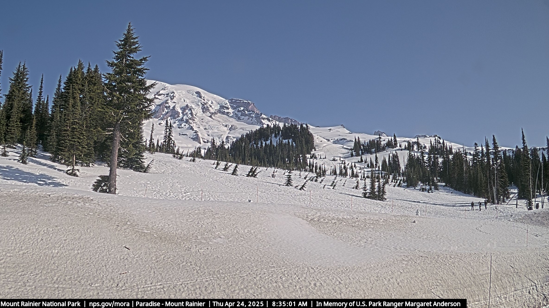
Paradise still has a large amount of snow as well - 14' as of 6/22.  Check out the webcam.

No opening dates have been announced yet for the Mowich Lake Road or Paradise Valley Road.  Did I mention that there is still a lot of snow up there?

Thursday, June 23, 2011

Yosemite National Park in Spring

Rainbow at the base of Lower Yosemite Falls.
I had planned this trip to Yosemite months in advance.  I targeted my visit for the first week in April to coincide with spring break for my daughter, but also to hit the flower show at their peak.  I spent a lot of time researching the area, referencing several different hiking and photography books, following Michael Frye's blog, (a personal favorite) and even exchanging some e-mails with Michael, who lives in the area. 

I had my itinerary set long before leaving, and was excited to return to this fabulous park.  What I didn't plan for was the crazy spring that mother nature had instore for us!

El Capitan reflected in snow melt pond.
Flowers?  We arrived at Upper Pines Campground to 2' of snow on the ground, and found the campground hosts offering shovels to campers to dig out tent spots!  This was going to be an interesting week indeed.

I spent my first evening checking out the views from Tunnel View.  The scene was made interesting with ample snow and some low level clouds, but the light never really materialized.  It would prove better during subsequent visits.

My first morning was spent at Sentinel Beach for sunrise.  Snowshoes would have been helpful in the deep, soft snow.  Fortunately the walk was fairly short.  After photographing  reflections of El Capitan in the Merced River, I found a small reflection pool in a side channel of the river, still mostly snow covered.  I would not be able to get to this location a couple days later.

Evening light on Half Dome.
Half Dome was the focus of my evening jaunts, and even daytime scouting trips. It's such a spectacular and prominent feature of the valley that I found it hard to notice much else as the sun began to go down.  There are many excellent locations to photograph Half Dome from in the valley.

The week spent in the valley was mostly sunny and warm and the snow melted fast.  However, evenings still remained quite cold, with temps dipping below freezing.  Our campground went into the shade early - around 3:30 or so, and became cold very fast.  The family quickly learned that tagging along with me on my evening photography ventures, where the sun stayed out as late as 7:00, was a much better option than freezing in camp! 

Upper Yosemite Falls
Upper Yosemite Falls is a head turner no matter where you are at in the valley it seems.  There were numerous vantages to photograph the upper falls from.  I photographed the falls mid-morning from Swinging Bridge and some nearby meadows.  But I think my favorite location was actually from the side of the road near Curry Village.  This vantage allows you to see more of the basin, which was still covered in snow during my visit.

Another excellent place to photograph the falls from is on trails from the opposite side of the valley.  However, snow prevented access to these during our visit.

In late afternoon, Bridalveil Fall became the waterfall attraction of choice, photographed from a road pullout in the valley, the TH parking lot and lower trail to the fall, and my favorite - Tunnel View.

Cathedral Spires reflection.
Another morning favorite was a tarn alongside the road that perfectly captured the reflection of Cathedral Spires.  I only spent one morning photographing here, but came away pretty happy with my results.

I found mid-morning to be the best time to photograph this reflection.  I arrived at first light, but found the scene most captivating with the shadows gone and everything fully lit by the sun.  I worked both horizontals and verticals with this scene - and liked them both.

Being alongside the road, I was never alone at any time here.  However I did not experience any compositional conflicts with other photographers.  It was an enjoyable morning to be out photographing in the valley, especially at such a serene setting.  The water held its reflection the entire morning.

El Capitan reflected in Merced River.
I returned to Sentinel Beach to find conditions much different from my previous visit.  Much snow had melted, making the gated road walk much easier.  It also entirely changed the physical characteristics of the beach itself.  The "snowmelt pond" that I had previously captured El Capitan's reflection in was now a deep channel of the river  itself, and was not still at all.  As a result, the river bar that I used to photograph reflections from was now inaccessible.

While I briefly had some company during my first visit to this beach (a couple I had actually met the evening prior at Tunnel View), I had it all to myself on my return visit.  However, I had better clouds and reflection opportunities during my first visit - just another reason why it is so beneficial to visit the same location multiple times to increase your chances of success.

Yosemite Valley from Tunnel View at sunset.
Tunnel View was an interesting location to shoot from.  I never shot from the viewpoint proper.  Instead, I followed the recommendation of Michael Frye's book, "The Photographer's Guide to Yosemite" (the definitive book on photographing Yosemite, in my opinion)and hiked a short ways up the trail to a prominent viewpoint.  Though I climbed the described amount of elevation, I never located the abandoned road his book mentioned.  However, I did still locate a viewpoint that I much preferred over that at the road.

I spent a few evenings at Tunnel View, and really only got decent light on my last visit.  I scouted Tunnel View almost every evening, however.  It was interesting to watch the crowds.  On clear, sunny days, evening crowds would be small with rarely a single DSLR present.  Throw some clouds in the afternoon sky and the heavy duty tripods would show up in force!  It was very easy to distinguish the professionals from the amatures, and easy to predict simply by looking towards the sky!

Half Dome reflected in a tarn.
On my last evening I stumbled upon my favorite location to photograph Half Dome thus far.  I pulled over to the roadside east of Yosemite Falls where I had seen numerous tripods set up each evening.  I prefer to include interesting forefronts in my compositions, so this location hadn't really caught my interest previously.  However, I didn't want to repeat locations on my last night; I wanted something new and different.

I set up my tripod roadside and pulled up a chair to wait for the special light to strike Half Dome's face, but was totally bored with the composition.  I noticed a foot path nearby heading out into the meadow and decided to go for a walk.  I found a nice reflection shot in a tarn with some interesting tufts of grass to put in the forefront.  Bingo!  I was in my happy place!  Unfortunately, the dramatic light I hoped for never came as a system was moving in and a cloud bank to the west blocked the sun's final rays.  So many things have to come together for that perfect image.  While we photographers control some of these, many we do not.

A coyote hunts in the snow-covered meadows near Curry Village.
A new system was forecast to dump 12 - 18" of new snow in the valley the next day, potentially closing the roads accessing (and more importantly, exiting) the park.  Temps were expected to dip into the low 20's.  Not wanting to be trapped, we packed up that morning and began our long, indirect drive home.  Even as we left, chains were required on both Highway 120 and 41.  These roads were closed a short time later.

We were blessed with a special sighting along the way however - a coyote hunting and successfully catching its morning breakfast in the meadows near Curry Village.  It was very fascinating to watch.

If you've liked the images appearing on this page, then you will be happy to know that you can view them and many more in my new Yosemite National Park gallery!

Some final comments about our visit:

Bicycles were an excellent way to get around in the valley.  I did much of my scouting during the day on bike, riding the entire valley loop on multiple occasions.  I highly recommend bringing them.

The shuttle buses offered an effective way to get around as well, but were much longer and restrictive.  They were also quite full during mid-day and seats were at a premium.  Understand they were still on their limited spring schedule during our visit.  I still believe they serve an excellent purpose and recommend using them - we did!

I had hoped to catch up with my friend and former Mount Rainier climbing ranger, Mike Gauthier during my visit.  Mike is now serving as Chief of Staff for Yosemite National Park.  Unfortunately for us, he was back up in our home state of Washington enjoying some down time during this particular week - next time, Gator!

Sunday, June 19, 2011

Kings Canyon National Park and John Muir Wilderness

Mt. Agassiz and Palisades reflected in Dusy Basin.
The Eastern Sierras are one of my favorite playgrounds.  I have returned multiple times to this wonderful area to enjoy what it has to offer - namely, rugged peaks and granite lake basins, with lots of off-trail exploration possibilities.

My first backpack in the John Muir Wilderness was over Piute Pass to a high lake in Humphreys Basin below Muriel Peak.  A storm blew through that evening, and cleared out just at sunset for amazing light on the peaks and clouds.  We were fortunate to stay dry, but did not get so lucky the following night.

On the same trip we spent a multi-day trip hiking over Kearsarge Pass to Kearsarge Lakes, then over Glen Pass to Rae Lakes.  From Rae Lakes, we spent time exploring Sixty Lakes Basin.  Bears were a problem in this area, though we didn't experience any problems personally.  The scenery was fantastic, and I hope to return to Rae Lakes again.

Cloudripper Peak reflected in Sixth Lake at sunrise.
I returned to the Eastern Sierra on subsequent solo trips.  From Lake Sabrina, I enjoyed a backpack to Blue Lake and on to Emerald Lake - located a short ways off trail.  I had the lake all to myself, despite regular foot traffic on the main trail.

My trek up to Sixth Lake below the Palisades was also spent camping by myself, and included some memorable reflection shots taken at sunrise, including Cloudripper Peak as seen above.

Venturing once again to the Palisades, I backpacked over Bishop Pass to popular Dusy Basin.  Again I found a secluded tarn off the beaten path, shared only with a lone coyote who sang to me throughout the evening.  On this trip I also visited nearby Knapsack Pass and climbed Columbine Peak.

All these images and more can now be seen in my new Kings Canyon National Park and John Muir Wilderness Gallery.  Please, enjoy!

Wednesday, June 15, 2011

Where's Don?

I can't believe it has been several weeks since my last update.  Typically, I am chomping at the bit to share the latest news and events going on with my photography.  Lack of postings certainly does not mean things are slow - quite the contrary.  I've been busy with submissions to various publications.  It's tedious and even boring work at times, but has the potential for an exciting outcome, which makes it all worth while.  I do hope to have news pertaining to some calendars and a tourist travel brochure to share soon.
"I need a cup holder"

Other things have been keeping me busy as well.  Yep, that's a boot on my foot in the picture to the left.  As some of you know, I fractured my ankle in early April while hiking in Redwood National Park.  I would like be able to tell you how I was traveling off-trail on an extremely exposed and dangerous traverse when the accident occurred, but it was actually a simple hike with family.  Takes the sexy right out of the story, huh?

Two miles from the trailhead, I rolled my ankle and heard a "pop".  I knew instantly.  I still had to walk the two remaining miles back to the car - not much fun.

Back home, x-rays confirmed an inversion fracture of the fibula in two places at the ankle joint.  An inversion fracture is when the tendon, instead of stretching or tearing, pulls away chips of bone.

So, I was introduced to a walking boot for six weeks.  Not so much fun.  No more runs, bike rides, or even walking with the kids around the neighborhood.  Instead, I got to sit around and rest my ankle and throw on a few pounds.

I've been out of the boot for a while now, and just finished with my physical therapy.  I had an excellent physical therapist in Nicole Nelson, and highly recommend her to anyone in the Fairwood area.

I am now on a home exercise program thanks to Nicole, working hard to strengthen my ankle and prevent this injury from happening again.  I have been biking for a few weeks and recently just started running again.  I have a lot of work ahead of me to get back in the shape I was in before my injury.  But it will happen!

Fill-in coaching the Fireballs.
I'm also the father of two very active kids.  Our son Brendan is taking swim lessons at nearby Lindbergh Pool and is improving immensely with each lesson.  Kids get to a point where they all of a sudden "get it" and their abilities take off.  Brendan is getting it.  Much like his sister did before him.  It's fun to watch.

Equally fun is being heavily involved with our daughter Karissa's soccer team.  She has only been playing since last fall, but is strong, competitive and fun to watch.  I help out with each practice, have filled in as a substitute coach (thanks, Coach Aaron), and have unofficially served as team photographer.

Needless to say, I'm very proud of my kids and excited to be a part of their activities and watch them grow and excel in them.  I wouldn't miss it for the world.

So there you have it, some behind the scenes so to speak of my life outside of photography, hiking and climbing.

Now, back to our regularly scheduled programing...

Thursday, May 26, 2011

Mount St. Helens - Norway Pass and Mount Margaret Backcountry Area

Mount St. Helens from Norway Pass.
Mount St. Helens offers excellent hiking with worthy destinations all around the mountain.  One of my favorite areas is the Mount Margaret Backcountry area near Windy Ridge.  The area provides classic views across Spirit Lake to St. Helens.

Bear Camp offers excellent camping, and is situated close enough to Mount Margaret to serve as a base camp for a hike to this magnificent summit.  Watch for elk herds in the area!

One of the highlights early in the hike is Norway Pass.  A great wildflower area, this pass affords excellent views down to Spirit Lake and Mount St. Helens.

The image above is not my favorite image from the area - not even in the top 5.  But it has been popular for publications.  It has appeared in a couple different wall calendars (one multiple times), and is currently the image for the month of May in Smith-Western's Mountains of Washington wall calendar.  It will also be appearing in the June issue of a national magazine publication.

I hope to have more Mount St. Helens news to share very soon - stay tuned!  In the meantime, you can view more images from this monument at in my Central/South Cascades gallery.

As always, thanks for visiting!

Monday, May 23, 2011

Photographing the Racetrack in Death Valley National Park

Sliding rock at southern end of The Racetrack
The Racetrack is probably the most intriguing feature in Death Valley National Park, involving sliding rocks on the barren playa.  You've surely seen the pictures.  They are very recognizable as the rocks leave a long trail behind.

Located between the Cottonwood Mountains to the east and the Nelson Range to the west, the Racetrack is exceptionally flat and level (only 1.5" height difference between its southern and northern end).  It's dry for almost the entire the year.  But when heavy rains do arrive, water rushes down these mountains onto the playa, forming a shallow lake.  It's short-lived as the hot desert sun quickly evaporates the water, leaving a surface of soft, slick mud.

Sailing stones on north end of playa.
The sliding rocks, or "sailing stones", slowly move across the slick surface of the playa with the aid of strong winter winds, leaving a track behind them.  This phenomenon has never been witnessed or filmed, likely because the remote playa is not approachable under such conditions.

These stones only move once every 2 to 3 years, and their tracks last 3 to 4 years.  Stones with rough bottoms tend to leave straight tracks, while smooth-bottomed stones wander.

Interesting, huh?  Most photographers think so!

There is a challenge to visiting this playa, however.  It is very remote, accessed via a very rough 28 mile road.  The Racetrack Road is best suited for high-clearance vehicles.  Flat tires are a common occurrence.  The road can be heavily washboarded, rattling suspensions, and must be driven slowly.  I would budget at least 3 hours for this drive.  Storms and flash floods can make the road undrivable.

Teakettle Junction.
The Racetrack Road is an interesting and scenic drive.  Flowers can line the early stretches of road in spring.  At about 9 miles in, the road passes through a Joshua tree forest with many photographic opportunities.  Legendary Teakettle Junction is reached 10 miles further.  Past Teakettle Junction was the roughest stretch of road during my visit - 9 miles of extremely washboarded road to the Racetrack.  These poor conditions continue to Homestead Dry Camp, in case that is your destination.

Excellent photography can be had in both morning and evening at the Racetrack.  Morning is considered the better light, but I achieved my best images while scouting the evening before.  The southern end of the playa tends to have the most rocks, while the north end sports The Grandstand, which makes a fun compositional backdrop if rocks are present.  There were no rocks near The Grandstand during my visit, to the shock of several photographers who had just visited the year prior.

Sliding rocks on the Racetrack.
Morning light happens fast here, so definitely spend time scouting the playa the day before for the best rocks and tracks.  You will also find that the rocks come in all shapes and sizes, and sometimes can be photographed in pairs.

Enjoy your visit and travel safely!

This is my last installment on photographing in Death Valley National Park.  I hope you've enjoyed my recommendations and tips, and that I have inspired you to visit this wonderful place yourself.  If you would like to see more images, please check out my Death Valley gallery.

Thanks for reading.  And as always, feel free to send me a note with any questions you may have that I have not answered here.

Thursday, May 12, 2011

National Geographic Geotourism Map

Recently I was preparing tear sheets for some upcoming mailings and I was reminded of this cover image for a National Geographic geotourism map. 

The geotourism map series promotes tourist spending in a way that puts their money back into the local economy and helps to sustain and support the community.  An example would be to eat at locally owned and operated eateries instead of chain food restaurants.

This image was taken at Spray Park in Mount Rainier National Park in early summer.  The white flowers are avalanche lilies, one of the first flowers to bloom after the winter snow melt.  I would typically target mid-July for such an image, but it will be much later this year due to the high volume of snow in our mountains.

This image also appears in my book Mount Rainier.

Friday, May 6, 2011

Photographing Fall Canyon in Death Valley National Park

Hiking Fall Canyon.
Fall Canyon is located just north of Titus Canyon (a highly recommended drive!).  It is one of the most spectacular canyons in Death Valley National Park.

The trail starts from the parking lot at the base of Titus Canyon, where the road is gated for one-way traffic coming the other way.  The trail leaves to the north and traverses to the wide fan of Fall Canyon, with excellent views down to the valley below along Scotty's Castle Road.

From its mouth, Fall Canyon is a deep gorge with amazing walls.  The canyon gets deeper and the walls more and more impressive the further into the mountain you go.

At several places within the first 3 miles, the wash squeezes through impressive narrows that force one to crane their necks to the walls above.  The canyon walls climb vertically for hundreds of feet, and are topped by even higher walls.  Vertical compositions work well at these spots.  I also recommend a warming filter.

Hiking Fall Canyon in Death Valley
National Park.
 The walls are colorful, and include shades of blue, tan, dark brown and red. As the sun's angle changes throughout the day, so do the vibrant shades of the rock.  The reds grow deeper in the evening as the sun sets, turning flaming red for the final show. 

At about 2.5 miles, the canyon is blocked by an 18 foot fall that poses a considerable challenge to the best of rock climbers.  This is a very scenic spot for photography of the steep walls and seemingly insurmountable fall.  Seemingly?  Yes, there is an easy way around.  Simply backtrack about 300 feet to find a path climbing upward to the south.  It climbs steeply up a chimney to the south, then mellows out as it climbs a ledge over a high spot and descends down to above the fall.

The next third of a mile contains the tightest narrows of the canyon, and are very photogenic.  The deep, dark, polished rock through this windy passage is extremely scenic, and the best part of hike!

I recommend focusing on vertical compositions to capture the feel of the towering walls above.  I believe that adding a subject matter for purpose of scale also works well.  Abstract patterns in the rock can also be played with.  Normal and wide-range lenses work well here.

At a quarter mile above the first fall, the canyon opens up until mid-canyon is reached in about 3.5 miles.  I did not venture up to mid-canyon, but have friends that thoroughly enjoyed it as a backpack (and continued further).  The lower canyon makes for an excellent half day excursion with endless photography opportunities.  Which ever way you choose to enjoy this area, do just that - enjoy!

If you wish to view more images from this area, feel free to visit my Death Valley gallery.


Tuesday, April 26, 2011

May/June Issue of Washington Trails Magazine

May/June Washington Trails Magazine
Washington Trails Association (WTA) originally started out as Signpost magazine in 1966. They have created Washington's largest volunteer trail maintenance program, and work actively to protect our trails and wilderness.  If you're not familiar with them, I strongly encourage you to visit their web site.  They offer a wealth of information for hikers, including current trail and road conditions, current issues affecting our trails and wilderness, information on volunteer programs, magazine subscription, and more.

I've been involved with WTA for many years.  My "Early Light on Prusik Peak" image won First Place in Landscape in their 2006 Pacific Northwest Photo Contest.  Since then, I've contributed images to their magazine and web site, and served as a panel judge for their annual photo contest.

The new May/June Washington Trails magazine includes one of my images of  Mount Rainier on its cover.  This image was taken just last summer from Spray Park in the evening hours as light softened on the mountain.  It was a beautiful evening to be in the mountains.

More of my images appear within the magazine.  They include an image of the Quinault River taken from Pony Bridge (Olympic NP), and also a couple that accompany an article penned by Eli Boschetti, offering suggestions for backpacking in Mount Rainier National Park.

If interested, you may view more images in my Mount Rainier and Olympic National Park galleries.

As always, thanks for visiting!

Friday, April 22, 2011

Photographing Devil's Cornfield in Death Valley National Park

Arrowweed at Devil's Cornfield
What trip to Death Valley National Park is complete without photographing a weed patch?  As funny as that sounds, arrowweed is a fantastic subject matter in the evening hours, catching the sun's soft rays as sunset approaches and turning a brilliant gold while casting its soft blue shadows.

Devil's Cornfield is located along CA190, about half a mile west of the Scotty Castle Road junction.  Parking is limited to pullouts alongside the road.  Though arrowweed is present on both sides of the road, the larger, more interesting stacks are located on the north side of the road, bordering the Mesquite Flat Dunes.

The area is certainly interesting, and offers much wandering and exploring for the "perfect" stack or line of stacks.  Erosion has played a key part in shaping the soil, exposing the roots and shaping the stacks of the arroweed.  Despite this intrusion, the plants thrive thanks to the underground waters of Salt Creek.  Coyotes and other wildlife can be seen the area.

Devil's Cornfield and Kit Fox Hills
As evening light arrives, the arrowweed stacks turn golden and the Kit Fox Hills to the east create a superbly scenic backdrop.  The light on the arrowweed is quick-lived - it changes fast.  Before you know it, they are in the shadows and you find yourself with a smile on your face, having witnessed another fantastic moment in Death Valley, and hopefully having captured the moment.

I arrived to this location with low expectations.  I left thoroughly impressed.  Don't overlook this gem!

Normal to wide-angle lenses best serve this area.  Be sure to bring a polarizer and GND filters if planning to include the Kit Fox Hills in any of your compositions.

More images from this area can be viewed in my Death Valley National Park gallery.

Thursday, April 14, 2011

Photographing Mesquite Flat Dunes in Death Valley National Park

Mesquite Flat Dunes at sunrise.
The Mesquite Flat Dunes are often referred to as Stovepipe Wells Dunes due to their close proximity to the town.  They are located about 2.2 miles east of Stovepipe Wells, to the north of CA 190.

The dunes are a popular draw to hikers, photographers, sand dune surfers, and more.  As a result, the dunes can get tracked up in a hurry, much to the frustration of photographers.

Though evening can provide excellent photography result with colorful skies to the north, sunrise is the ideal time to photograph the dunes.  The biggest reason for this is simply the tracks in the sand.  As the dunes are very popular during the day, evening finds the area victim to the evidence of all these visitors.  If you are lucky, overnight winds will erase such evidence, allowing you a fresh start in the early hours.

Sand ripples at Mesquite Flat Dunes
Clear skies at sunrise offer numerous photographic opportunities.  Early light turns the dunes golden, and ripple patterns in the sand are highlighted with shadow definition.  Light is best 15 to 30 minutes after sunrise.

As the sun rises shadows become more pronounced and one can play with negative space between the dunes and line patterns.

I recommend finding an area not recently visited by others, and looking for a prominent spot with lots of texture and offering views of higher, more prominent dunes for you subject matter.  This will give you lots of options and you will be surprised at how quickly time flies!

As the sun rises higher in the morning sky, you can wander down into the depressions and find other interesting compositions.  Rock "tile" and mesquite trees and offer additional elements to play with.  They can be an additional element to your composition, offer isolation opportunities, or in the case of the rock "tile", offer very fun abstract possibilities!

Mesquite Flat Dunes in spring.
In contrast to clear mornings, overcast light flattens out the dunes and will diminish the contrast that defines shapes, texture and patterns.

Be sure and keep your eyes open for critters and animal tracks.  Sidewinder, deer and coyote tracks can be fun to encounter and offer interesting photo ops.  Lizards are also a common sight.

All lenses should be made available during your visit to the dunes.  Normal range and wide angle lenses will allow you to play with the ripple patterns in the sand and add depth to your composition.  Zoom lenses will allow you to isolate distant dunes and work around tracked up sand.  They will also allow you to play with shadows and negative space.

I recommend taking an evening walk to scout the area you wish to photograph, then return in the morning to shoot.  Again, cross your fingers for overnight winds to erase the previous days tracks.  When planning your visit to the dunes, try to time it after a windy day or night, or even during a windy morning (make sure to protect your camera).  My visits were during calm conditions and I found the amount of tracks to be extremely frustrating.